
Uncovering the Secrets of Earth’s Geomorphology: How Geologists Are Using Landforms to Find Mineral Deposits
Understanding Earth’s Distinct Features
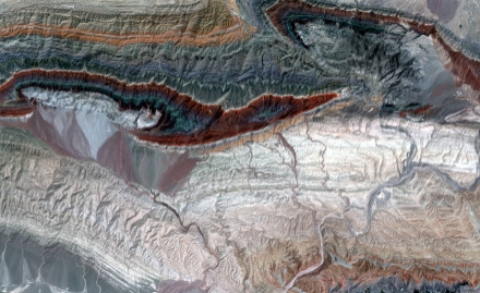
Geologists study the shape and structure of the Earth’s surface to uncover valuable mineral deposits. They analyze landforms such as mountains, valleys, and rivers to identify potential sites for exploration.
Identifying Remote Locations
By examining the terrain and topography of remote regions, geologists can pinpoint areas with high mineral potential. Landforms can indicate the presence of mineral-rich formations below the surface.
Utilizing Cutting-Edge Technology
Advances in technology, such as satellite imaging and 3D mapping, enable geologists to study landforms in great detail. This allows them to better understand the Earth’s geomorphology and locate mineral deposits with accuracy.
Interpreting Geological Processes
Geologists interpret how geological processes have shaped the Earth’s landforms over millions of years. By analyzing the formation of mountains, valleys, and other features, they can uncover valuable insights into the Earth’s mineral composition.
Predicting Future Resource Discoveries
By studying the Earth’s geomorphology, geologists can predict where future mineral deposits may be found. This information is crucial for guiding exploration efforts and ensuring the sustainable extraction of valuable resources.
In conclusion, the study of Earth’s geomorphology plays a vital role in the discovery and extraction of mineral deposits. Geologists use landforms to uncover valuable insights into the Earth’s geological history and predict where future resources may be found. Through the use of advanced technology and expert analysis, they are unlocking the secrets of Earth’s geomorphology to benefit society and the environment.