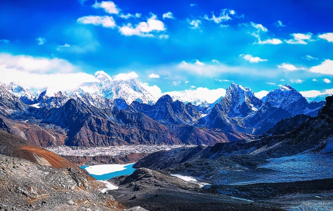
The Himalayas: A Geological Wonder
The Himalayas, stretching across five countries in South Asia, are home to some of the highest peaks on Earth. But what makes this mountain range so unique? Geomorphologists have long been studying the processes that have shaped the landscape of the Himalayas over millions of years.
The Collision of Tectonic Plates
The Himalayas are the result of the collision between the Indian and Eurasian tectonic plates. Around 50 million years ago, the Indian plate began pushing into the Eurasian plate, causing the land to uplift and form the towering peaks we see today.
Glaciers and Ice
The Himalayas are famous for their glaciers, which have played a crucial role in shaping the landscape of the region. These massive sheets of ice slowly erode the rock beneath them, carving out valleys and leaving behind moraines.
Earthquakes and Landslides
The collision of tectonic plates also means that the Himalayas are prone to earthquakes and landslides. The intense pressure between the two plates can build up over time, leading to sudden movements that can cause widespread destruction.
Rivers and Valleys
The rivers that flow through the Himalayas are some of the longest and mightiest in the world. They cut through the mountains, carving deep valleys and gorges along the way. The Himalayas are also home to the highest river sources in the world, including the Ganges and the Brahmaputra.
The Future of the Himalayas
As the Earth’s climate continues to change, the Himalayas face new challenges. Rapid glacial melting and changing precipitation patterns are putting immense pressure on the fragile ecosystem of the region. Geomorphologists continue to study the Himalayas in order to better understand and protect this unique and precious landscape. Unlocking the mysteries of the Himalayas is not only important for scientific knowledge but also for the preservation of this natural wonder for future generations.

