
Uncovering the Hidden Secrets of Watershed Geomorphology
What is Watershed Geomorphology?
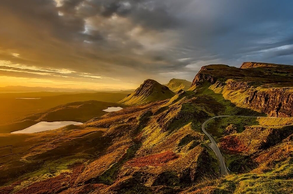
Watershed geomorphology is the study of the shape, topography, and features of a watershed – the area of land that drains into a specific body of water, such as a river, lake, or ocean. This field of study focuses on the natural processes that shape the land in a watershed, including erosion, sediment transport, and deposition.
Why is it Important?
Understanding watershed geomorphology is crucial for managing and protecting our natural resources. By studying the landforms and processes within a watershed, scientists can predict how water and sediment will move through the landscape, how habitats will be impacted, and how pollutants may be transported. This knowledge is essential for making informed decisions about land use, water quality, and conservation efforts.
Uncovering Hidden Secrets
Through fieldwork, mapping, and advanced technologies such as LiDAR (Light Detection and Ranging), researchers are able to uncover hidden secrets of watershed geomorphology. By analyzing the shape of the land, identifying features such as stream channels, floodplains, and terraces, and measuring the flow of water and sediment, scientists can piece together the history of a watershed and understand how it has evolved over time.
Mapping the Landscape
One of the key tools in watershed geomorphology is mapping. Scientists create detailed maps of the landforms in a watershed, such as hills, valleys, and ridges, as well as the networks of streams and rivers that flow through the landscape. These maps help researchers analyze patterns of erosion and sediment transport, identify areas at risk of flooding or landslides, and determine the best strategies for managing and restoring the watershed.
Protecting Our Water Resources
By uncovering the hidden secrets of watershed geomorphology, scientists can better protect our water resources. By understanding how water flows through the landscape, where pollutants are likely to accumulate, and how habitats are connected, researchers can develop strategies for improving water quality, restoring ecosystems, and promoting sustainable land use practices.
In conclusion, watershed geomorphology is a vital field of study that helps us better understand and protect our natural resources. By uncovering the hidden secrets of how water shapes the land, scientists can make informed decisions that benefit both people and the environment.