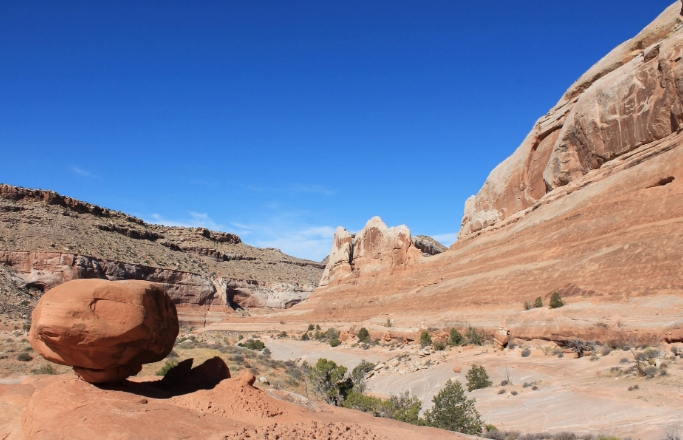
Geomorphology is the study of the Earth’s landforms and the processes that shape them.
From mountains to valleys, rivers to coastlines, geomorphology can be observed in a wide variety of landscapes.
Mountains: Where Tectonic Forces Collide
Mountains are some of the most dramatic landforms on Earth, and they are formed by the collision of tectonic plates.
As plates push against each other, massive forces are generated that create fold mountains, such as the Himalayas, or volcanic mountains like Mount Etna.
Valleys: Shaped by Erosion
Valleys are low-lying areas between mountains or hills, and they are often carved out by erosion processes such as rivers or glaciers.
Rivers can cut deep valleys through rock over time, while glaciers can create U-shaped valleys as they flow down mountainsides.
Coastlines: Where Land Meets Sea
Coastlines are dynamic landscapes where land and sea interact, and they are constantly changing due to processes such as erosion and deposition.
Waves can erode cliffs, while sediment carried by rivers can build up beaches and coastal landforms.
Deserts: Landscapes of Extremes
Deserts are arid landscapes with little vegetation, and they are shaped by the forces of wind and water.
Wind can create sand dunes by carrying grains of sand over vast distances, while occasional rains can carve out dry riverbeds known as arroyos.
Plateaus: High and Flat
Plateaus are elevated, flat-topped landforms that are often created by tectonic uplift or volcanic activity.
They can be found in various parts of the world, such as the Colorado Plateau in the United States or the Deccan Plateau in India.
In conclusion, geomorphology is a fascinating field of study that helps us understand how the Earth’s landscapes are formed and shaped by natural processes. By exploring the dynamic world of geomorphology, we can gain a deeper appreciation for the beauty and complexity of our planet.

