
Fluvial geomorphology is the study of how rivers shape the land through erosion, transport, and deposition of sediment.
**Key Concepts**
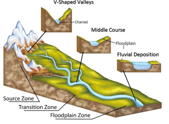
Rivers are important geologic agents that shape the Earth’s surface over time, carving out valleys and creating floodplains.
Understanding fluvial geomorphology can help scientists predict how rivers will behave in different conditions, such as during extreme weather events or in response to human activities.
**Erosion and Sediment Transport**
Rivers erode the land through the process of moving water and sediment, wearing down rocks and carrying fine particles downstream.
Sediment transport by rivers plays a key role in shaping the landscape, creating features such as meanders, deltas, and alluvial fans.
**Importance in Environmental Science**
Fluvial geomorphology is essential for understanding how rivers interact with their surrounding environment, influencing water quality, habitat creation, and flood risk.
By studying fluvial processes, scientists can better manage river systems for environmental conservation and sustainable development.
**Human Impacts**
Human activities such as dam construction, channelization, and urbanization can alter natural river processes, leading to issues such as increased erosion, sedimentation, and flooding.
Understanding fluvial geomorphology can help mitigate these impacts and maintain healthy river ecosystems.
In conclusion, fluvial geomorphology plays a vital role in environmental science by providing insights into the dynamic processes of rivers and their interactions with the landscape. By studying and applying this knowledge, we can better manage and protect our valuable water resources for future generations.